Hong Kong
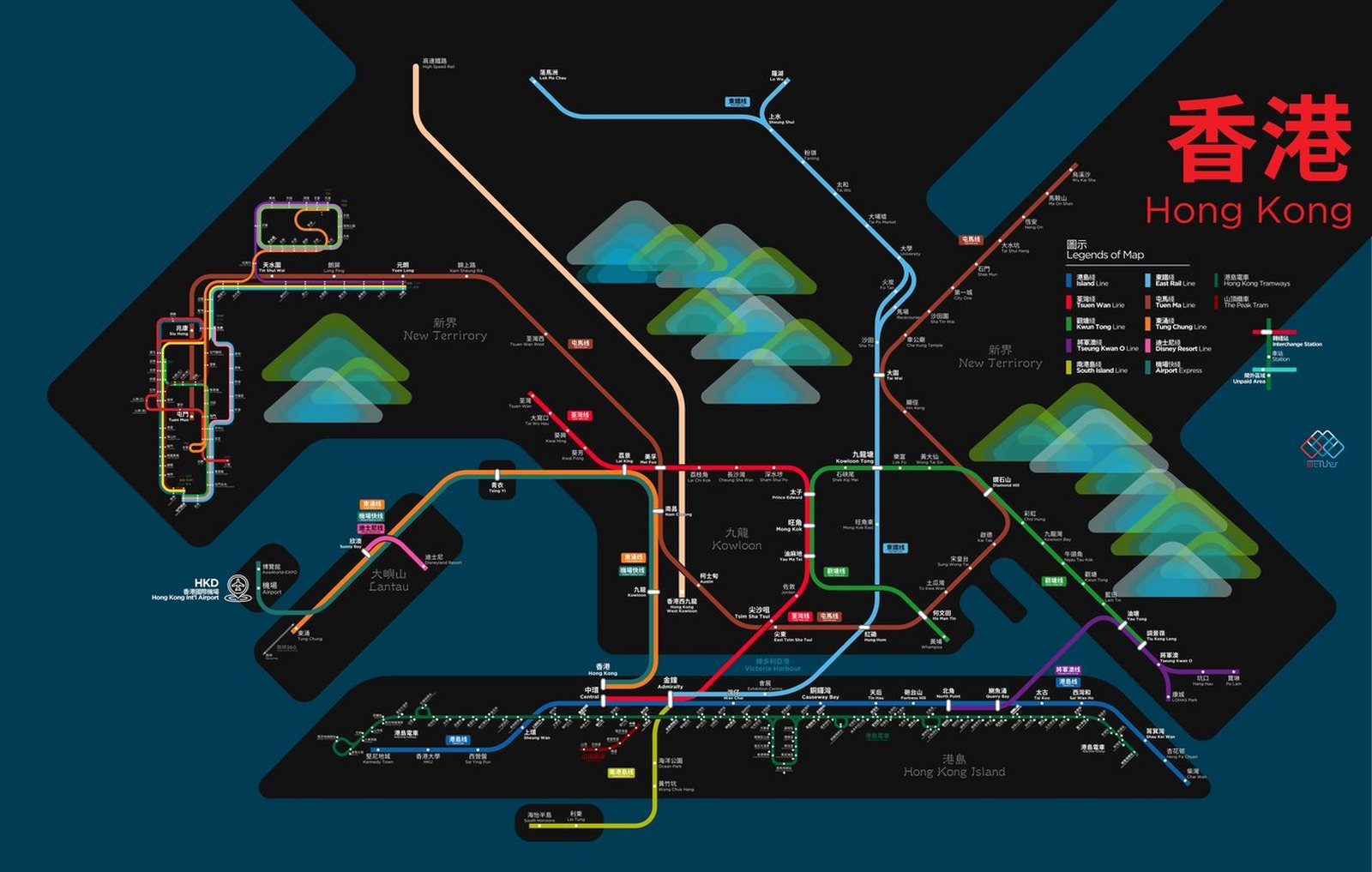
Hong Kong got its first metro line in 1979, when the opening MTR section ran from Shek Kip Mei to Kwun Tong, though the Kowloon-Canton Railway had already been running since 1910. In the four decades since, the network has grown from a short stretch in Kowloon to reach Hong Kong Island, the New Territories, and Lantau. The Airport Express, opened with the new airport in 1998, runs from the city straight to Chek Lap Kok, and in 2022 the East Rail Line crossed the harbor to Admiralty, becoming the fourth rail crossing of Victoria Harbour and giving riders from the northeastern New Territories a direct trip to Hong Kong Island.