Ottawa
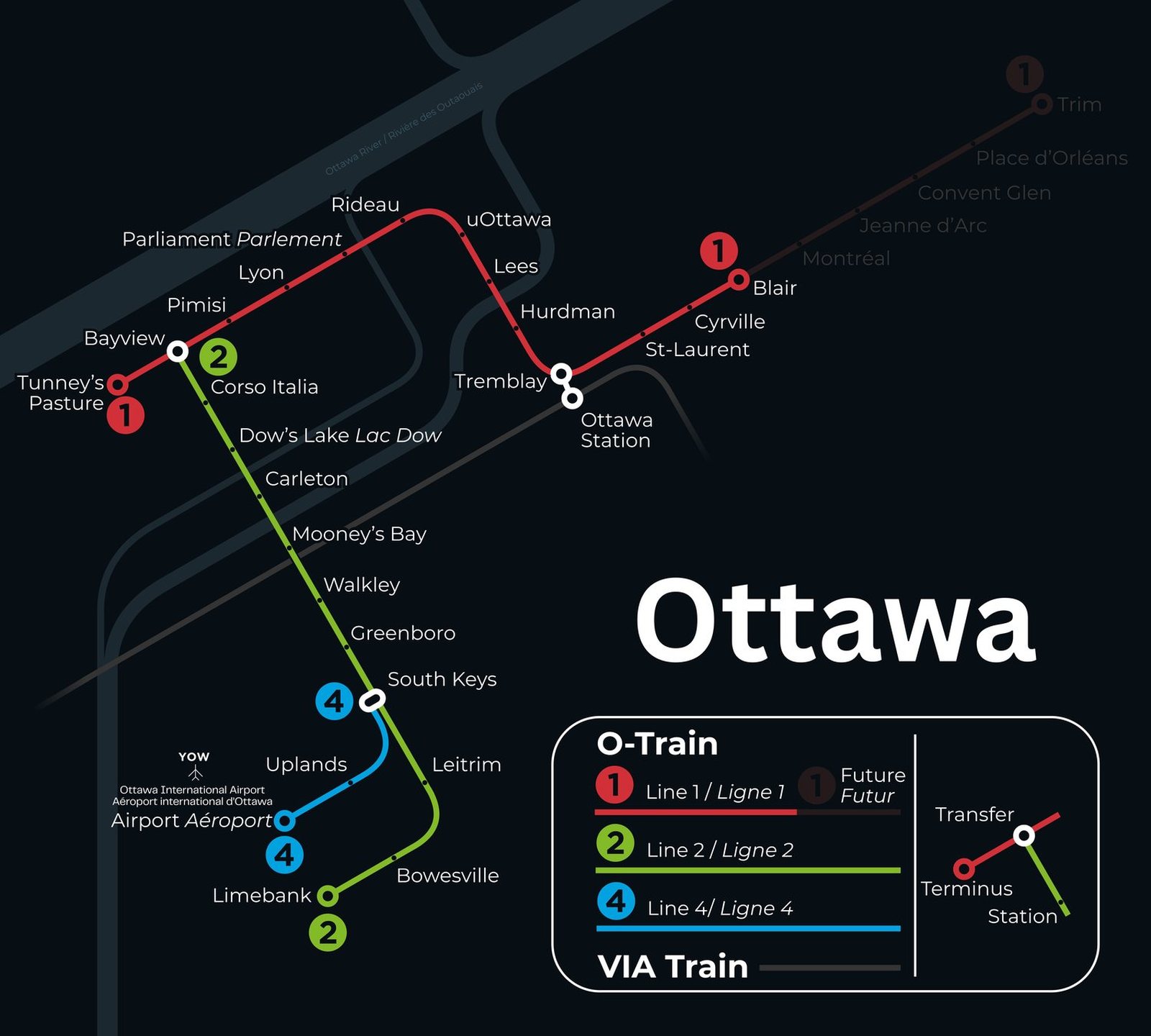
Ottawa got its first urban rail line in October 2001, when the O-Train began running as a pilot diesel service. That route is today's Line 2. In September 2019 the Confederation Line, Line 1, opened as light rail from Blair to Tunney's Pasture, crossing downtown in a 2.8 km tunnel. The network has kept growing since. In January 2025 Line 2 reopened after about four years of work, extended south to Limebank, and Line 4 opened the same day, branching off at South Keys so travelers can ride the train to Ottawa Airport.