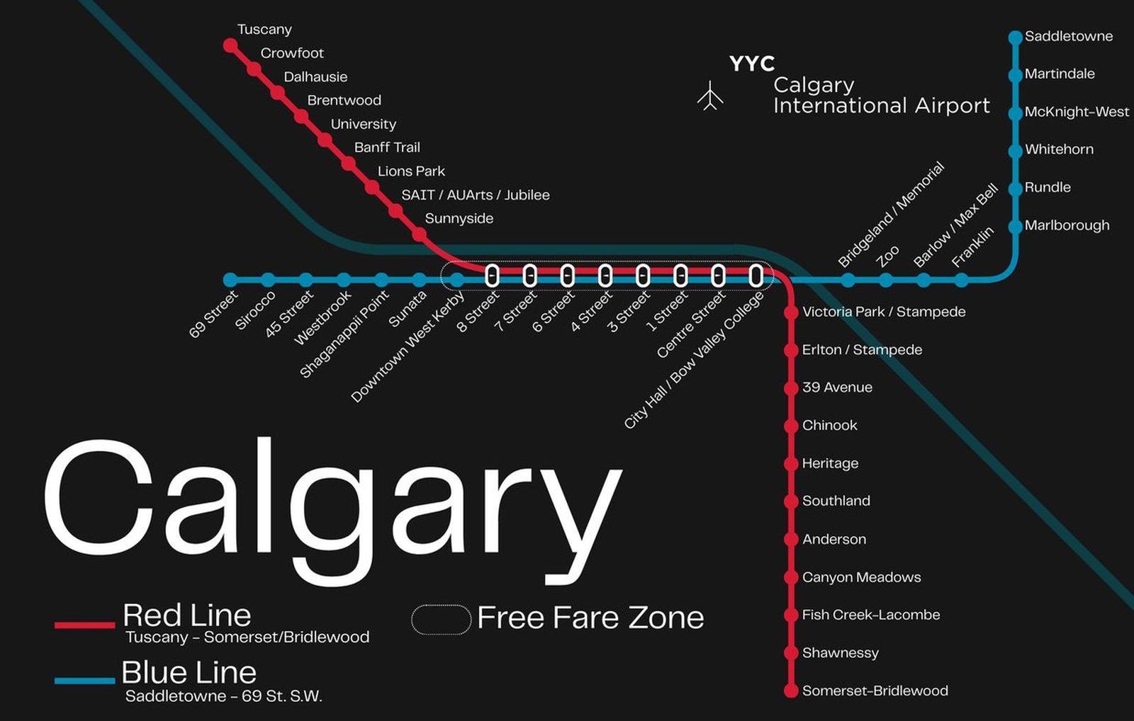
Calgary
Calgary got its first light rail line in May 1981, when the CTrain South Line opened. Rides along 7th Avenue downtown are still free, so riders can make short trips in the core without paying. In the forty-plus years since, the network has grown into two routes, the Red and Blue lines. In 2001 the CTrain switched to wind-generated electricity, and in 2012 the Blue Line was extended west, bringing the western neighborhoods onto the network. The planned Green Line is under construction, with its scope and schedule still being worked out.