Gwangju
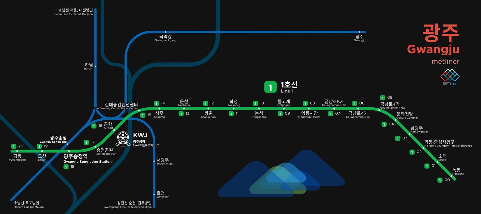
Gwangju got its first subway line in 2004, when Line 1 opened between Nokdong and Sangmu. The line reached Pyeongdong in 2008, giving it 20 stations, most of them underground. The network is still growing. Construction of Line 2, a loop around the city, began in 2019, and its first phase, about 17 km with 20 stations, is expected to open at the end of 2028, bringing the subway to many more parts of the city.