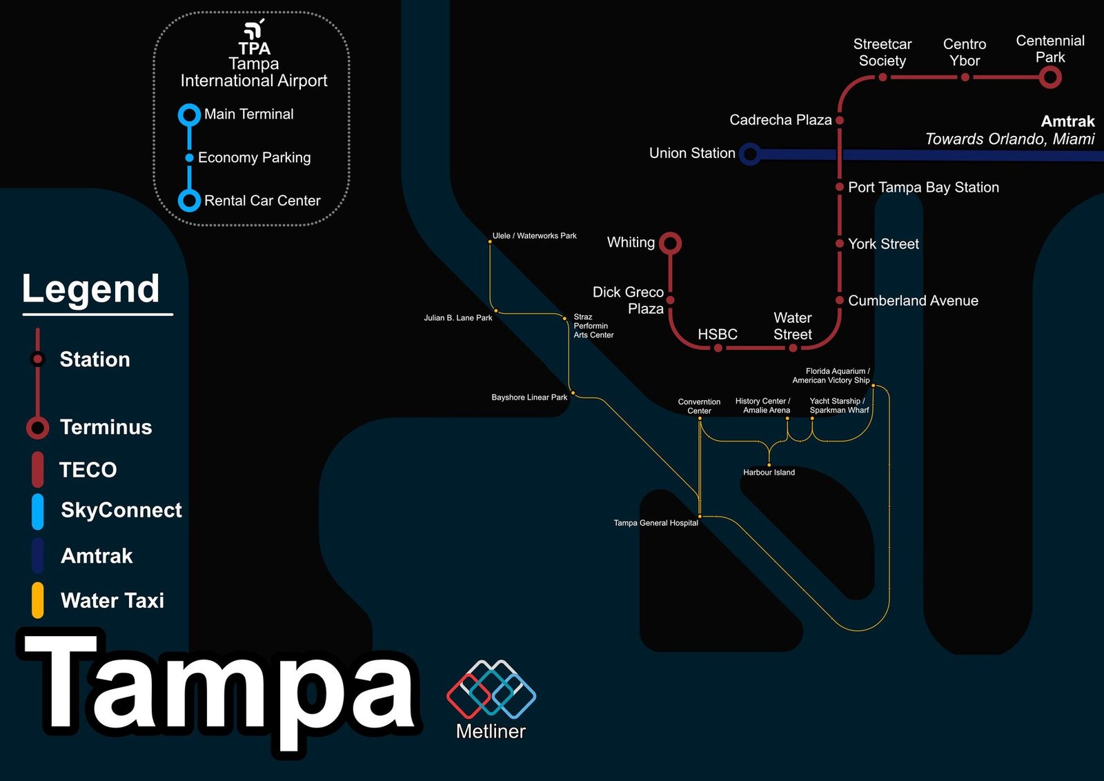
Tampa
Tampa got its modern rail system in October 2002, when the TECO Line Streetcar opened. Its vintage style cars run from Ybor City, the historic cigar making district, through the Channel District to downtown. In December 2010 the line was extended to Whiting Street, bringing it to about 2.7 miles and 11 stations, and in October 2018 the streetcar dropped its fares and became a free way to get around downtown. A plan to extend the line north is still in the planning stage.