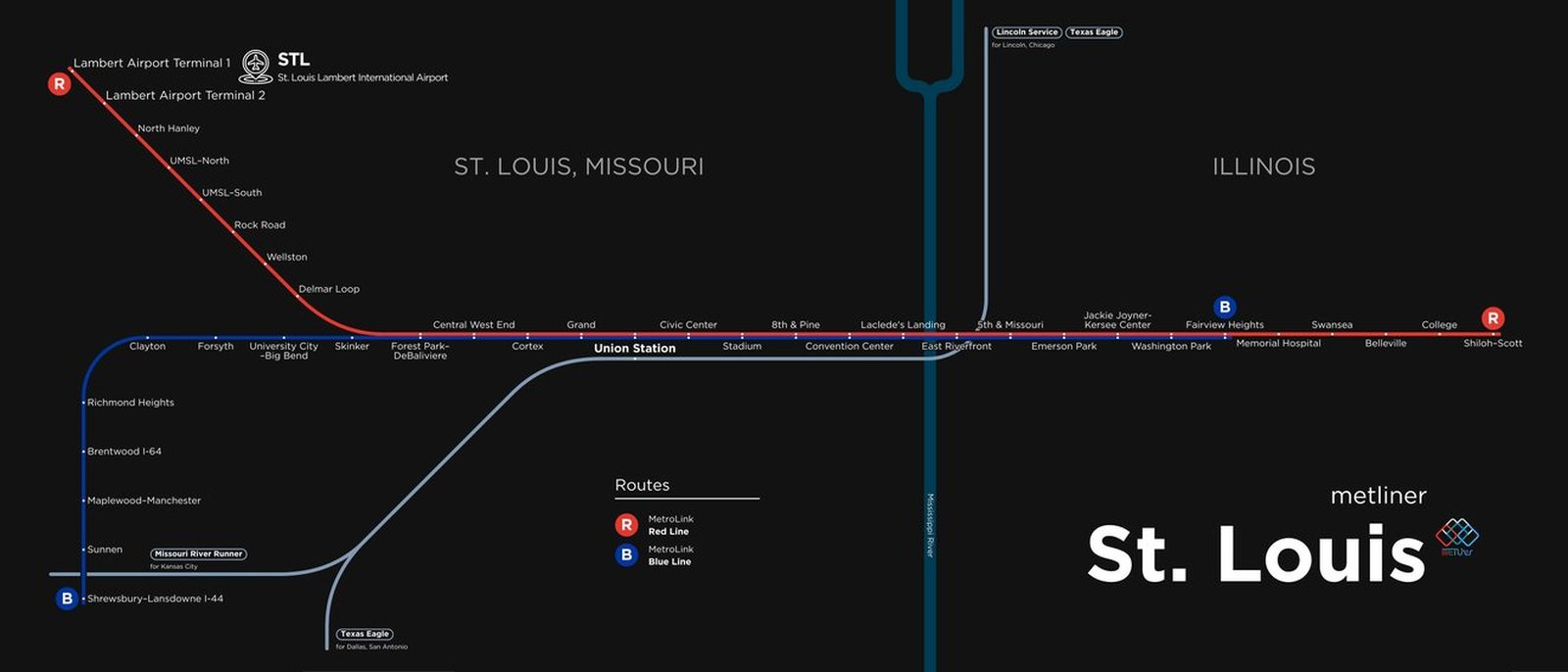
St. Louis
St. Louis got its modern rail system in July 1993, when MetroLink light rail opened from North Hanley through downtown and across the Mississippi River to East St. Louis, Illinois. In the thirty years since, it has grown into two lines, the Red and the Blue, with 38 stations and about 46 miles of track. In 1994 the line was extended to Lambert International Airport, in 2003 it reached Scott Air Force Base on the Illinois side, and in 2006 a new branch opened southwest to Shrewsbury. An extension to MidAmerica Airport has been built and is now in testing.