Salt Lake City
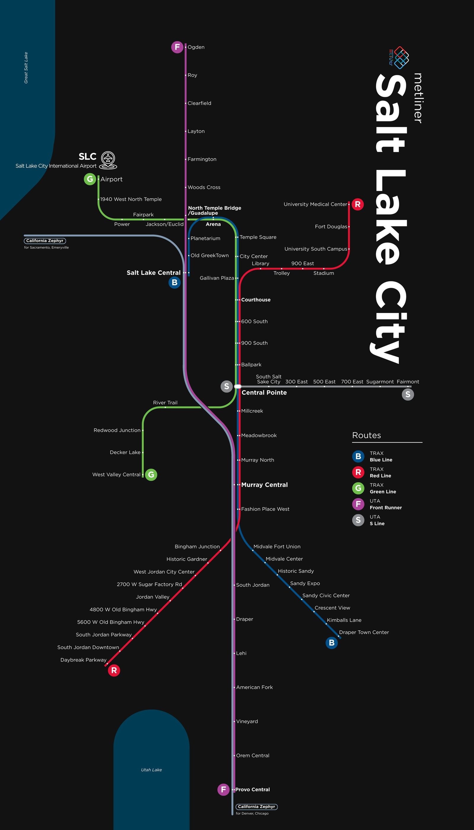
Salt Lake City got its modern rail system in December 1999, when TRAX light rail opened from downtown south to Sandy. The network has since grown into a system of light rail, commuter rail, and streetcar. In April 2008 FrontRunner commuter trains began running from Ogden to Salt Lake City, and in 2012 the line was extended south to Provo, linking about 80 miles of cities along the Wasatch Front. In April 2013 the TRAX Green Line reached Salt Lake City International Airport, and TRAX now has 3 lines and 52 stations.