Norfolk
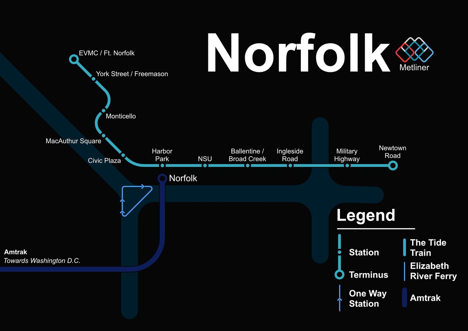
Norfolk got its modern rail system in August 2011, when The Tide opened as the first light rail line in Virginia. It runs from the Eastern Virginia Medical Center area through downtown and east to Newtown Road at the Virginia Beach line, about 7.4 miles with 11 stations. In December 2012 Amtrak's Northeast Regional began serving Norfolk from a station next to the Harbor Park light rail stop, and in 2016 Virginia Beach voters rejected funding to extend the line into their city, so The Tide remains a single line today.