New York
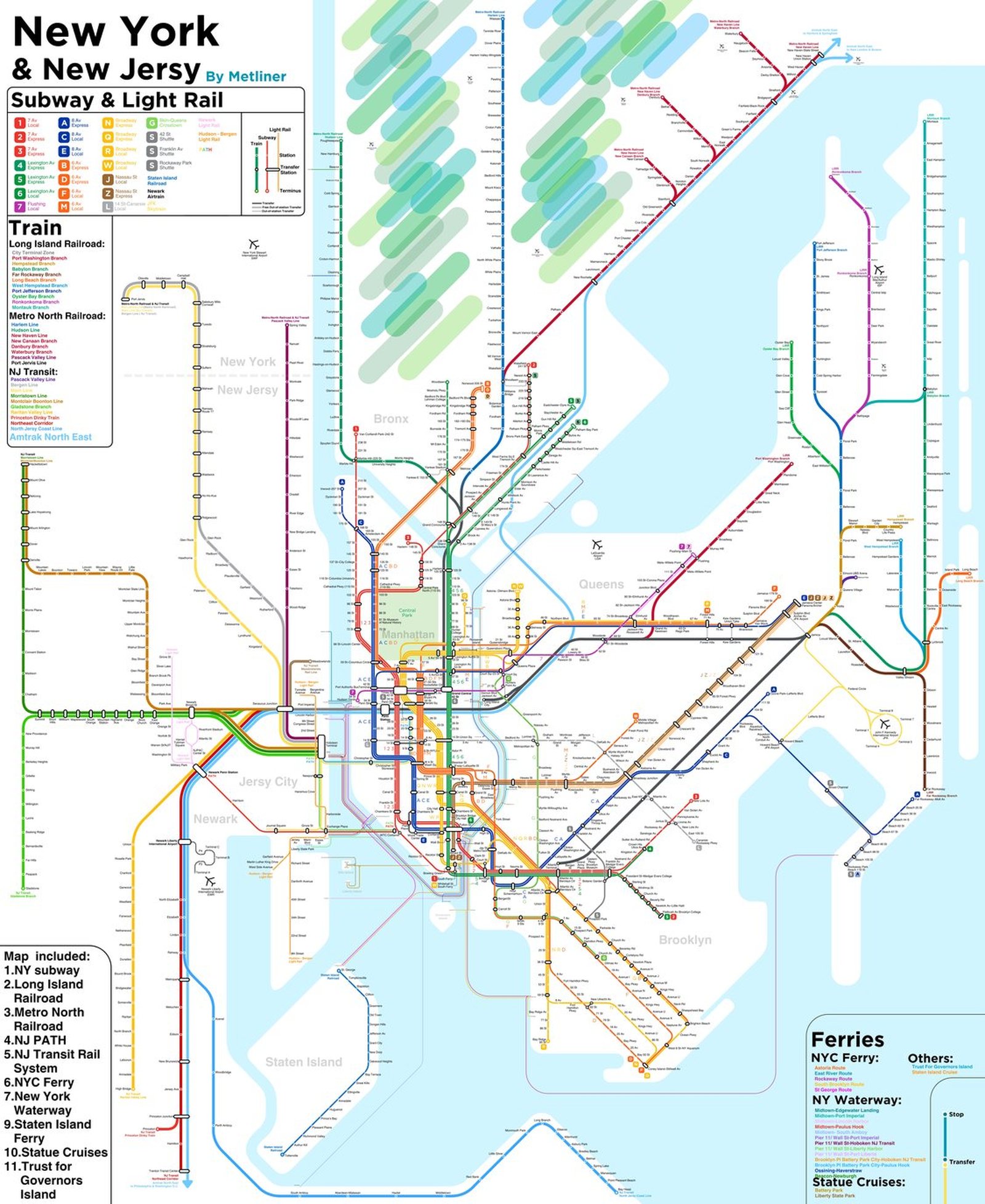
New York got its first subway on October 27, 1904, when the IRT opened from City Hall to 145th Street. The privately run IRT and BMT and the city owned IND were unified into one system in 1940, which now has 472 stations, while the Long Island Rail Road, Metro-North, and PATH under the Hudson carry the network out to Long Island, upstate New York, Connecticut, and New Jersey. In January 2017 the first phase of the Second Avenue Subway opened 3 new stations on the Upper East Side, and in 2023 Grand Central Madison opened, bringing LIRR trains to Manhattan's East Side for the first time.