Little Rock
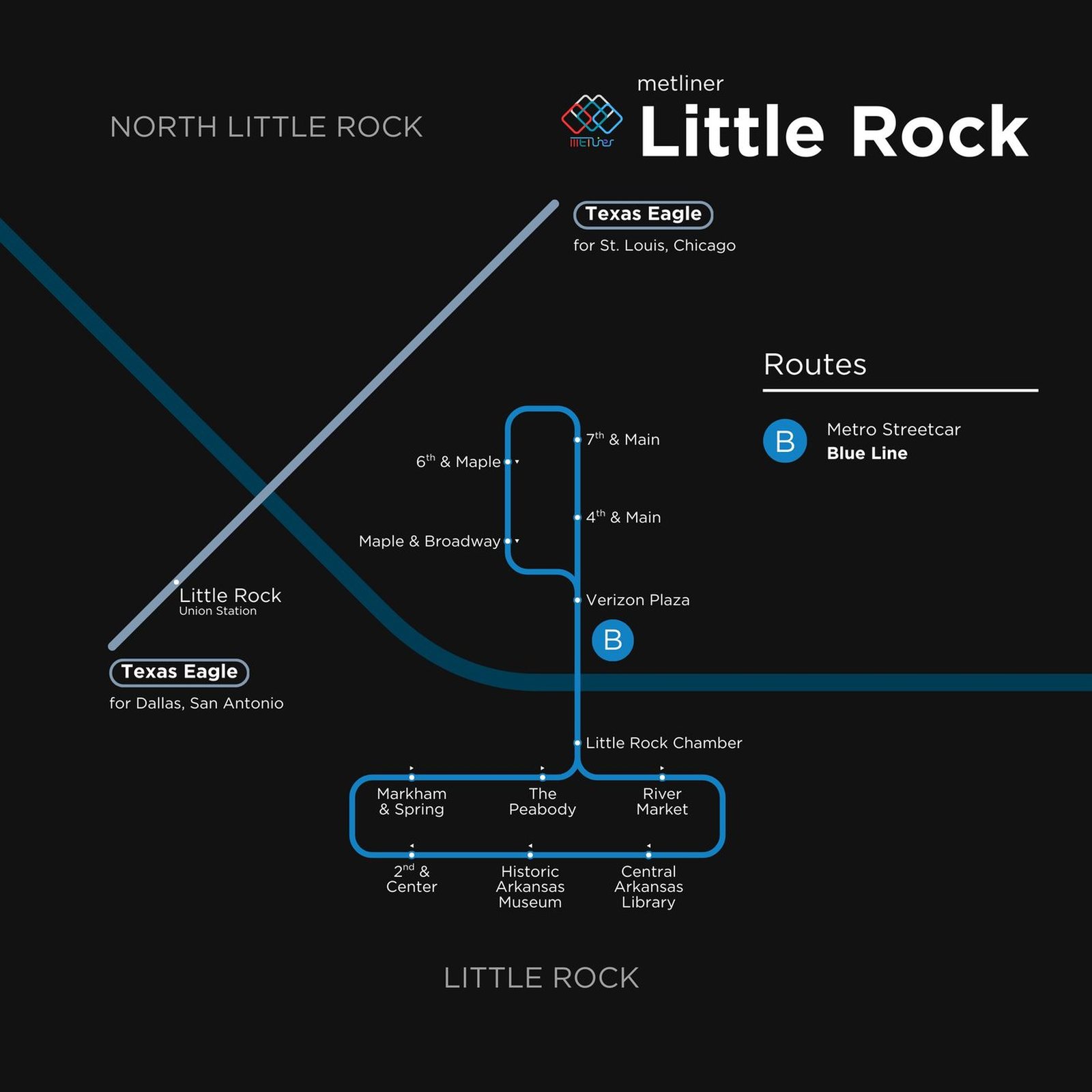
Little Rock got its modern rail system in November 2004, when the River Rail streetcar opened. Its vintage style cars cross the Arkansas River, linking downtown Little Rock with North Little Rock on the other bank. In February 2007 the line was extended east to the Clinton Presidential Center, bringing it to about 3.4 miles and 15 stops, and in 2015, when the transit agency became Rock Region METRO, River Rail was renamed the Metro Streetcar. Three stops near the Clinton Center are currently closed for the I-30 highway project and are expected to reopen in 2027.