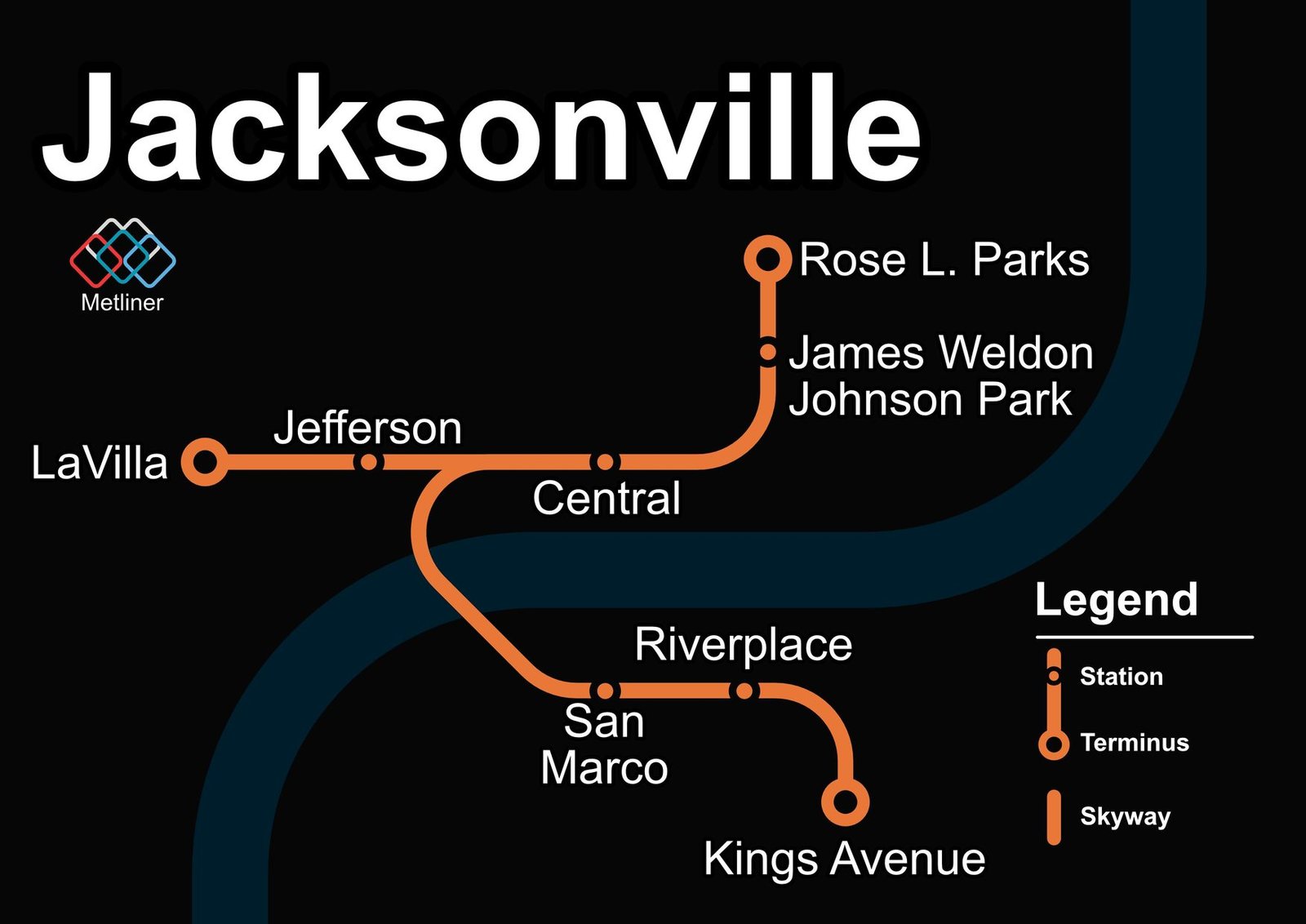
Jacksonville
Jacksonville's Skyway opened downtown in 1989 as a short automated elevated line, about 0.7 miles long with 3 stations. The system was later rebuilt and extended. In 1997 it reopened with Bombardier monorail trains and a northern extension, and in 1998 it crossed the St. Johns River on the Acosta Bridge to San Marco on the south bank, eventually reaching about 2.5 miles and 8 stations, all free to ride. JTA has announced that Skyway passenger service will be suspended in November 2026.