Houston
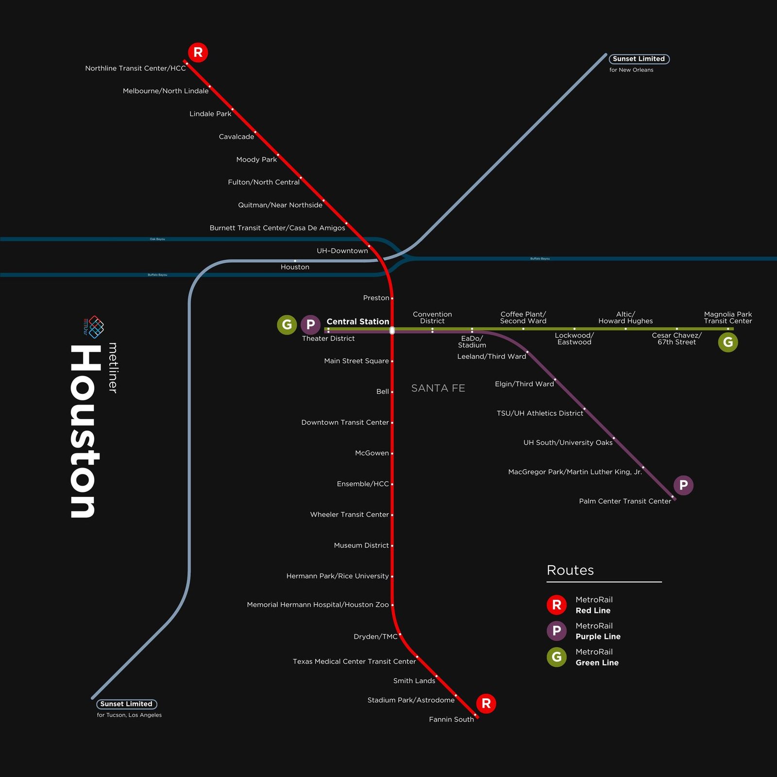
Houston got its modern light rail on January 1, 2004, when the METRORail Red Line opened along Main Street. In the twenty years since, the network has grown from a single north to south route into three lines. In December 2013 the Red Line was extended 9 stations north to Northline Transit Center, and in May 2015 the Green and Purple lines opened together. The Green Line runs east into the East End, and the Purple Line heads southeast past Texas Southern University and the University of Houston, bringing light rail to the neighborhoods east of downtown.