Detroit
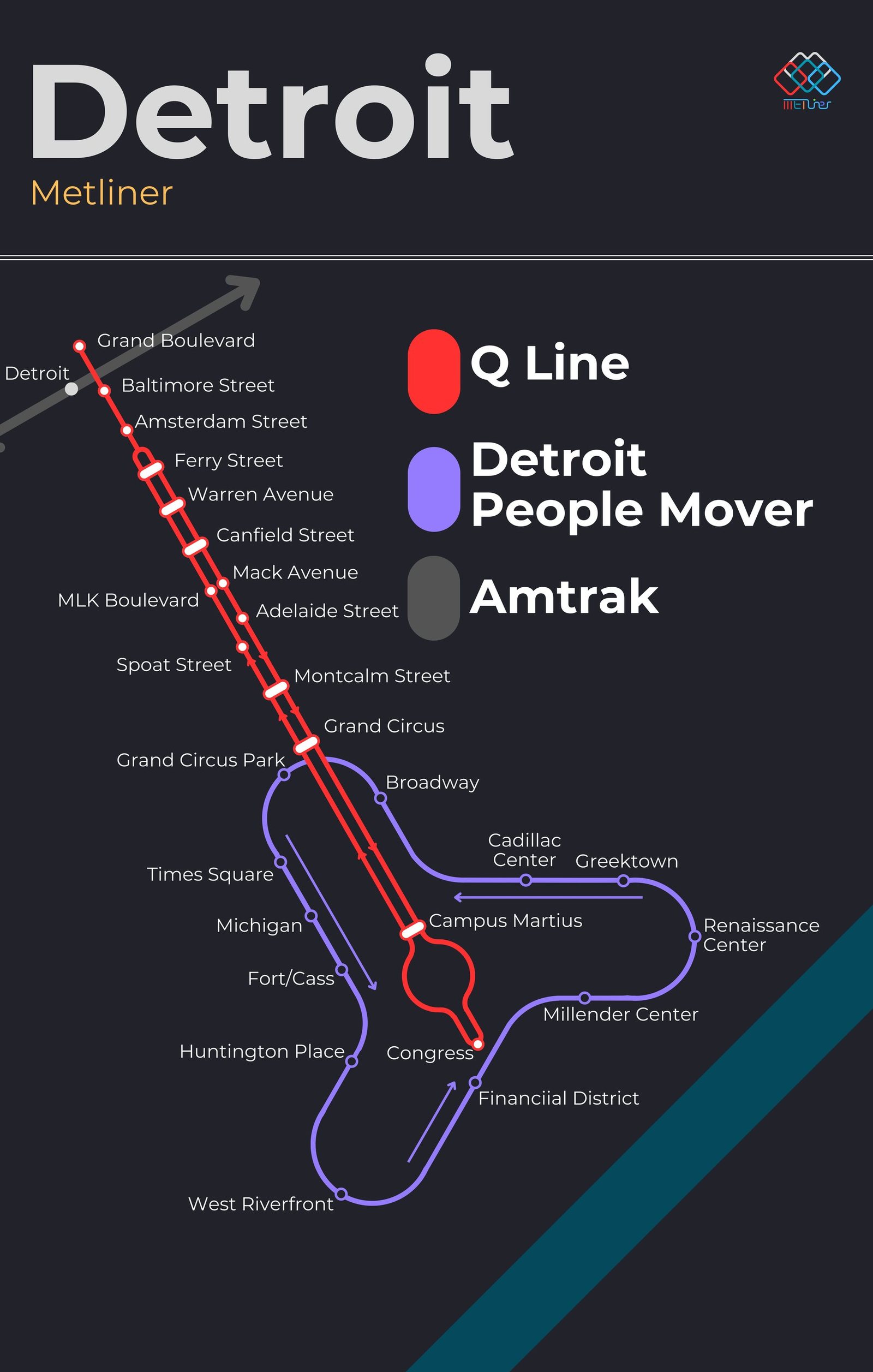
Detroit got its modern rail system in July 1987, when the People Mover opened. The driverless elevated loop runs one way around downtown, about 2.9 miles long with 13 stations. In May 2017 the QLine opened on Woodward Avenue, running about 3.3 miles from downtown to Grand Boulevard and connecting with the People Mover at three stations, and in 2024 the People Mover dropped its fares, so both lines are now free to ride.