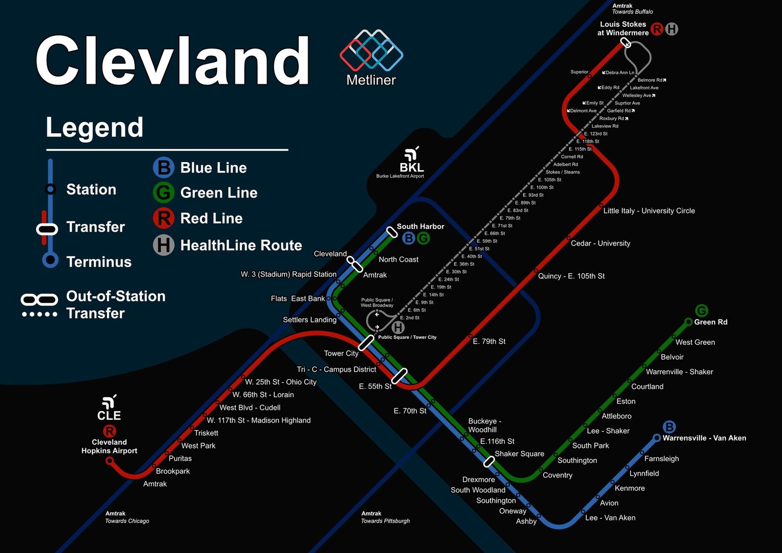
Cleveland
Cleveland got its rapid transit in March 1955, when the eastern section of the RTA Red Line opened, though the Blue and Green lines to Shaker Heights trace their roots back to 1913. All the lines meet at Tower City. In November 1968 the Red Line was extended to Cleveland Hopkins Airport, the first rail link to an airport in North America, and in 1996 the Waterfront Line opened, carrying the Blue and Green lines on through the Flats along the Cuyahoga River.