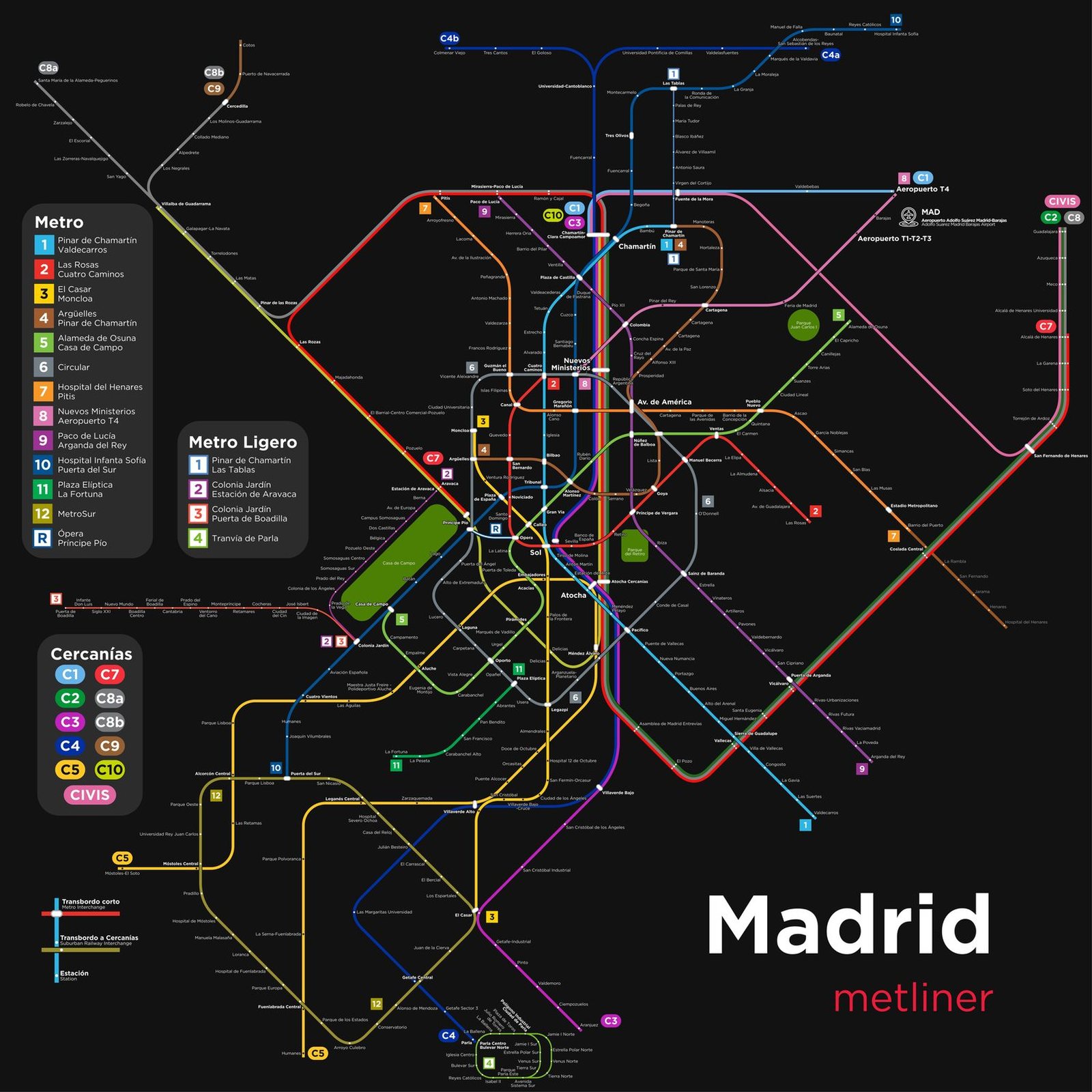
Madrid
Madrid got its first metro line in October 1919, when King Alfonso XIII opened Line 1, a 3.5 km route from Sol to Cuatro Caminos. In the century since, the network has kept growing, adding about 172 km between 1995 and 2011 alone. Line 8 reached Barajas Airport in 1999 and the new Terminal 4 in 2007, and Line 12, MetroSur, opened in 2003 as a 41 km loop linking five towns in the southern suburbs.

