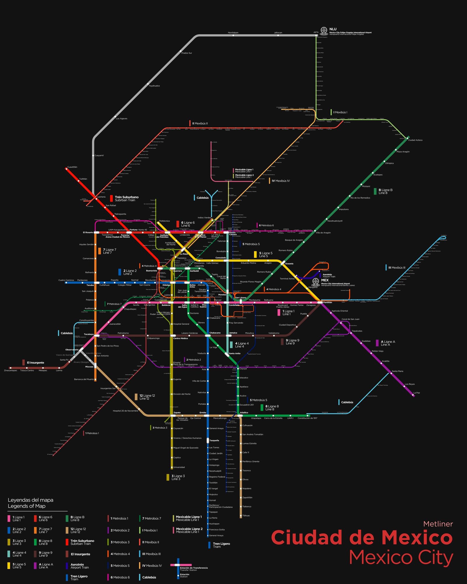
Mexico City
Mexico City got its first metro line in September 1969, when Line 1 opened between Zaragoza and Insurgentes. Every station has its own pictogram, designed by Lance Wyman so that riders who could not read could still find their way, and most lines still run on rubber-tired trains. In the fifty-plus years since, the network has kept expanding. Line A, opened in 1991, was the first to reach into the State of Mexico, and Line 12, opened in 2012, ran from Mixcoac to Tlahuac in the south as the longest line of its time.

